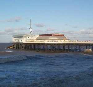
Cromer tide gauge site
The tide gauge equipment is located within Cromer lifeboat station, with the pressure points attached to a leg of the lifeboat
house slipway
Click here
to see a map of the site in a separate window.
Tide gauge location
The tide gauge equipment is housed in a heated GRP cabinet within the lifeboat station with two full tide and mid-tide pressure points. All pressure lines are monitored by the POL data logger.
 The tide gauge is levelled to the tide gauge bench mark supported by Ordnance Survey auxiliary marks.
External users
Sea level pressures and/or elevations from this site, levelled to the National Geodetic Network, are supplied to the following authority:
- Environment Agency, Anglian Region
Site history
1984 – Temporary tide gauge system installed with an Aanderra recorder
1988 – DATARING system installed with two full tide bubblers
1996 – Tide Gauge relocated on the pier during refurbishment of the lifeboat station; new steelwork with two full tide and mid-tide pressure points were attached to a leg of the pier
1999 – DATARING system installed in lifeboat station with existing full tide bubblers
2000 – New POL data logger installed
2001 – New steelwork with two full tide sensors and a mid-tide sensor installed on the slipway leg of the lifeboat station
| Location | |
| Latitude | 52° 56.058'N |
| Longitude | 1° 18.096'E |
| Grid ref | TG 2198 4253 |
| Earliest data | 1988 |
| Tidal levels | |
| HAT | 5.74 m |
| LAT | 0.22 m |
| MHWS | 5.10 m |
| MHWN | 4.06 m |
| MLWN | 1.97 m |
| MLWS | 0.87 m |
| H for 2024 | 5.74 m |
| L for 2024 | 0.22 m |
| H for 2025 | 5.62 m |
| L for 2025 | 0.32 m |
| MSR | 4.23 m |
| MNR | 2.09 m |
Abbreviations
HAT – highest astronomical tide
LAT – lowest astronomical tide
MHWS – mean high water springs
MHWN – mean high water neaps
MLWN – mean low water neaps
MLWS – mean low water springs
H – highest for year
L – lowest for year
MSR – mean spring range
MNR – mean neap range
Measurement devices
Tide gauge systemsFull-tide bubbler
Half-tide bubbler
Direct pressure transducer
Tide gauges
Ott pneumatic gauge
Munro float gauge
Wellhead float gauge
Lea float gauge
Instruments
DATARING logger
Datum probe