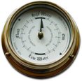
Tide clocks and watches are practical ways of indicating the state of the tide, in addition to consulting local tide tables.
Most tide clocks work by using a 12 hour 25 minute cycle. Generally in the UK and Ireland they vary in accuracy between plus or minus 30 minutes over a 30-day period. Therefore it is necessary to reset them using local tide tables every month or so.
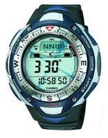
Some watches with a moon/tide mode require lunitidal intervals so that they can indicate high and low waters. There are two definitions for this interval, which depends on whether adjacent high waters, or the mean of high waters over a lunar month are being considered.
The mean lunitidal intervals (mean high water intervals) are calculated using this equation:
Use the values from the table to set the moon/tide mode of your watch. These values should be sufficient information for watches that use the lunitidal interval to indicate high and low waters. Click on the column headings to sort the values – the default order of the following list is by adjacent locations around the coast.
Tarbert Island (River Shannon)
52° 35.2'N
9° 21.5'W
5:17
Galway
53° 16.1'N
9° 2.9'W
4:50
Cork (City)
51° 54.0'N
8° 27.3'W
4:15
Ringaskiddy
51° 49.9'N
8° 19.4'W
5:15
Cobh
51° 51.0'N
8° 17.8'W
5:09
Malin Head
55° 19.8'N
7° 22.4'W
6:07
Londonderry
54° 59.5'N
7° 19.0'W
8:10
Barrow Bridge
52° 16.8'N
7° 0.2'W
5:25
Coleraine (River Bann Entrance)
55° 10.2'N
6° 46.4'W
6:50
Portrush
55° 12.3'N
6° 39.6'W
6:47
Stornoway
58° 12.3'N
6° 23.3'W
6:49
Rosslare Harbour
52° 15.4'N
6° 20.3'W
5:25
St. Mary's
49° 55.0'N
6° 18.7'W
4:31
Dublin (North Wall)
53° 20.8'N
6° 13.5'W
11:16
Port Ellen (Islay)
55° 37.6'N
6° 11.3'W
3:07
Tobermory
56° 37.3'N
6° 3.9'W
5:49
Belfast
54° 36.1'N
5° 55.2'W
10:54
Larne
54° 50.9'N
5° 47.8'W
10:55
Bangor (Down, Northern Ireland)
54° 40.0'N
5° 40.3'W
10:57
Newlyn
50° 6.1'N
5° 32.9'W
4:36
Oban
56° 24.8'N
5° 28.6'W
5:38
Ullapool
57° 53.7'N
5° 9.4'W
6:55
Portpatrick
54° 50.4'N
5° 7.2'W
11:27
Newquay
50° 25.1'N
5° 5.2'W
4:53
Falmouth
50° 9.4'N
5° 4.2'W
5:02
Milford Haven
51° 42.2'N
5° 3.2'W
5:58
Kinlochbervie
58° 27.3'N
5° 2.8'W
7:10
Fishguard
52° 0.2'N
4° 58.6'W
7:09
Millport
55° 45.1'N
4° 55.8'W
11:49
Port Erin
54° 5.1'N
4° 46.3'W
11:05
Greenock
55° 56.9'N
4° 44.6'W
11:55
Holyhead
53° 19.4'N
4° 37.6'W
10:04
Douglas
54° 8.9'N
4° 28.0'W
11:16
Plymouth (Devonport)
50° 22.9'N
4° 10.8'W
5:19
Ilfracombe
51° 12.6'N
4° 6.6'W
5:36
Aberystwyth
52° 24.4'N
4° 5.5'W
7:55
Barmouth
52° 43.1'N
4° 2.9'W
8:14
Cromarty Firth
57° 41.1'N
4° 2.1'W
11:33
Moray Firth
57° 36.0'N
4° 0.4'W
11:37
Mumbles
51° 34.2'N
3° 58.4'W
5:57
Swansea
51° 36.5'N
3° 55.7'W
5:57
Llandudno
53° 19.9'N
3° 49.5'W
10:41
Workington
54° 39.2'N
3° 34.7'W
11:27
Torquay
50° 27.5'N
3° 31.7'W
5:51
Minehead
51° 12.9'N
3° 28.3'W
6:11
Rosyth
56° 1.3'N
3° 26.7'W
1:53
Hilbre Island
53° 23.1'N
3° 13.8'W
10:57
Barrow (Ramsden Dock Entrance)
54° 5.6'N
3° 13.5'W
11:24
Halfway Shoal
54° 1.4'N
3° 11.9'W
11:11
Leith
55° 59.4'N
3° 11.0'W
1:54
Roa Island
54° 4.2'N
3° 10.4'W
11:20
Hinkley Point
51° 13.0'N
3° 7.4'W
6:19
Wick
58° 26.5'N
3° 4.9'W
11:07
Liverpool (Gladstone Lock)
53° 27.0'N
3° 1.1'W
11:04
Birkenhead (Alfred Lock)
53° 24.3'N
3° 0.9'W
11:09
Fleetwood
53° 55.1'N
3° 0.5'W
11:15
Liverpool (Princes Pier)
53° 24.4'N
3° 0.0'W
11:09
Newport
51° 32.7'N
2° 59.2'W
6:44
Eastham
53° 19.5'N
2° 57.0'W
11:22
Heysham
54° 2.0'N
2° 55.5'W
11:14
Avonmouth
51° 30.4'N
2° 43.2'W
6:57
Weymouth
50° 36.4'N
2° 27.0'W
6:36
Portland
50° 35.6'N
2° 26.2'W
6:40
St. Helier
49° 10.5'N
2° 7.0'W
6:18
Aberdeen
57° 8.7'N
2° 3.6'W
0:50
Bournemouth
50° 42.9'N
1° 52.5'W
9:24
Christchurch (Quay)
50° 43.8'N
1° 46.8'W
10:37
Lymington (Entrance)
50° 45.2'N
1° 31.4'W
11:02
North Shields (River Tyne)
55° 0.6'N
1° 25.8'W
3:04
Southampton
50° 53.7'N
1° 24.3'W
11:19
Sullom Voe
60° 27.6'N
1° 18.1'W
9:13
Cowes (Isle of Wight)
50° 46.1'N
1° 17.9'W
11:21
River Tees (Entrance)
54° 38.9'N
1° 8.9'W
3:18
Lerwick
60° 9.3'N
1° 8.4'W
10:45
Portsmouth
50° 48.8'N
1° 6.1'W
11:16
Blacktoft
53° 42.4'N
0° 43.5'W
6:58
Whitby
54° 29.6'N
0° 36.8'W
3:35
Littlehampton
50° 47.9'N
0° 32.5'W
11:08
Scarborough
54° 16.9'N
0° 23.4'W
3:49
Hull
53° 44.3'N
0° 19.9'W
5:59
Shoreham
50° 49.7'N
0° 14.9'W
11:06
Immingham
53° 37.9'N
0° 11.2'W
5:35
London Bridge
51° 30.5'N
0° 5.3'W
1:10
Withernsea
53° 43.6'N
0° 2.6'E
4:37
Newhaven
50° 46.9'N
0° 3.5'E
11:05
North Woolwich
51° 29.9'N
0° 3.6'E
0:44
Bull Sand Fort
53° 33.7'N
0° 4.1'E
5:16
Tabs Head (Rivers Witham/Welland)
52° 56.0'N
0° 5.0'E
6:13
Spurn Point
53° 34.2'N
0° 6.4'E
5:12
West Lighthouse (River Nene)
52° 48.5'N
0° 12.6'E
6:17
Boygrift
53° 17.7'N
0° 19.2'E
5:38
Gibraltar Point
53° 5.3'N
0° 20.0'E
5:54
Tilbury
51° 27.3'N
0° 20.3'E
0:18
Roaring Middle Light (Wash)
52° 58.6'N
0° 20.9'E
6:04
Skegness
53° 8.7'N
0° 20.9'E
5:47
West Stones (River Great Ouse)
52° 49.7'N
0° 21.5'E
6:19
King's Lynn
52° 45.3'N
0° 23.4'E
6:34
Hunstanton
52° 56.4'N
0° 29.2'E
6:11
Coryton
51° 30.7'N
0° 32.5'E
12:24
Inner Dowsing Light
53° 19.0'N
0° 35.0'E
5:35
Southend
51° 31.7'N
0° 43.0'E
12:11
Sheerness
51° 26.8'N
0° 45.0'E
12:12
Dungeness
50° 54.8'N
0° 58.7'E
11:14
Shivering Sand
51° 29.9'N
1° 4.7'E
11:59
Mistley Quay (River Stour)
51° 56.7'N
1° 4.8'E
11:30
Walton-on-the-Naze
51° 50.7'N
1° 16.5'E
11:25
Harwich
51° 56.8'N
1° 17.1'E
11:18
Cromer
52° 56.1'N
1° 17.7'E
6:30
Dover
51° 7.6'N
1° 20.2'E
11:27
Felixstowe
51° 57.5'N
1° 20.8'E
11:05
Margate
51° 23.4'N
1° 22.8'E
11:47
Gorleston (Great Yarmouth)
52° 34.3'N
1° 44.3'E
8:17
Lowestoft
52° 28.3'N
1° 45.1'E
8:57